The maps available on this site were compiled for the INSROP (International Northern Sea Route Programme) Working Paper No. 90 in 1997. Contact the Secretariat for full resolution AdobeIllustrator or .eps files.
General topical maps:
Map 1.1: Administrative subdivision of the North of the Russian Federation (287 KB)
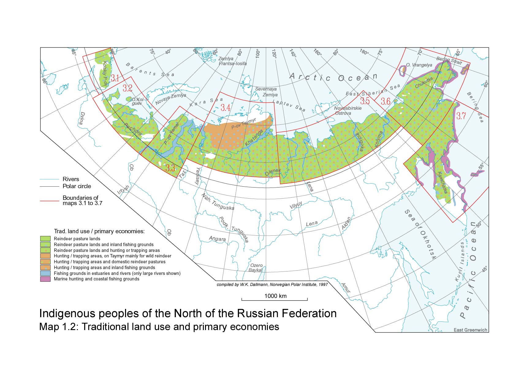
Map 1.2: Traditional land use and primary economies (260 KB)
Map 1.3: Geographical distribution (306 KB)
Map 1.4: Natural environment (248 KB)
Regional maps (ethnic groups and environmental factors):
Map 3.1: Kola (344 KB)
Map 3.2: Nenets (420 KB)
Map 3.3: Yamal (341 KB)
Map 3.4: Taymyr (358 KB)
Map 3.5: Northern Sakha (342 KB)
Map 3.6: Chukotka (277 KB)
Map 3.7: Kamchatka (271 KB)